Improved maps – and accuracy
The National Hurricane Center (NHC) has announced a few new changes to their forecast models for the upcoming 2025 hurricane season that begins June 1. They include a smaller and more accurate “cone of uncertainty,” greater detail on inland watches and warnings, and initial storm advisories issued sooner – three days ahead of storms.
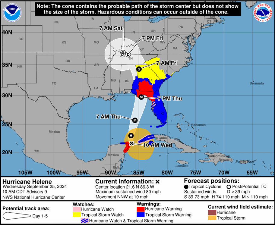
Back in 2024, NHC’s infamous “cone of uncertainty” got a major overhaul, displaying watches and warnings for inland counties as well as their coastal counterparts. While these warnings were issued to many inland counties by local National Weather Service offices, the information wasn’t readily available on NHC maps until last year. This year, they’re adding new map symbols – diagonal pink and blue lines – to delineate counties where both a hurricane watch and tropical storm warning is in effect.

A prototype of the inland enhancements to the National Hurricane Center’s Cone of Uncertainty for 2025. Source: NHC
This year’s cone of uncertainty will be 3-5% smaller than in 2024, reflecting improved accuracy in forecast predictions. In fact, according to its 2024 Verification Report Preview, the NHC had its best “forecast track performance” in its history. “The mean track errors at every forecast interval – 12, 24, 36, 48, 60, 72, 96, and 120 hours – broke records for accuracy. The long-term trends are very pronounced and show significant progress at lowering track errors,” according to the report. The cone is still misunderstood by some, who think it represents the only areas that could see storm impacts. Instead, the cone represents the probable center track of a tropical cyclone, whose effects, depending on where the center actually passes, could extend many miles beyond the shaded cone area.
Also new for this year, the NHC will be announcing storms further ahead of landfall – even if watches have not been issued – to try to stay ahead of the hurricanes. The NHC initial storm “advisory” will now be issued 72 hours in advance, an improvement from the current 48 hours advance advice.
The NHC is also going to add a national rip current risk map and add storm surge info for certain communities like the Hawaiian Islands. Rip currents and storm surge are some of the more dangerous and unsung parts of hurricanes and tropical storms, with roughly 1 in 6 direct storm deaths caused by rip tides and rough surf, the second deadliest threat over the last decade.

