Balancing long- and short-term costs
The National Institute of Building Sciences (NIBS) and Fannie Mae have developed version 2.0 of their Resilience Incentivization Roadmap – a rigorous study on mitigation investment, and an FAMU-FSU researcher is leading a team to map vulnerable infrastructure in West Florida. Both in this week’s Environmental and Engineering Digest.

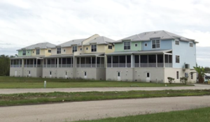
Elevated homes with tin roofs in Florida to protect them from wind damage. Courtesy, GAO
Resilience Investment: The Resilience Incentivization Roadmap 2.0 is ushering in a new age of damage mitigation to both the economy and the environment – incentivizing both public and private sectors to upgrade and overhaul their current infrastructure. The 150-page report delineates the need for public and private sectors to work together to create “mutually reinforcing contracts” wherein co-beneficiaries can help with the rising costs of insurance. NIBS suggests the most cost-effective plan is to build with flood mitigation in mind, and the second-best thing is when repairing older houses, to retrofit them with the same flood mitigating technology.
But, in many instances, the insurance premiums paid by individual stakeholders will end up costing them more money than they can justify in the short-term, even though the long-term benefits were made abundantly clear throughout the report. The suggested framework is as follows: develop flood resistance certification programs, test a new incentives program, test that new buildings with flood resistance have added market value, and finally engage private insurers to further champion resilience-focused efforts. Mortgage holders and governments could offer monetary incentives in these instances to bolster disaster response and cooperation between the public and private sectors, as well as save everyone money along the way.

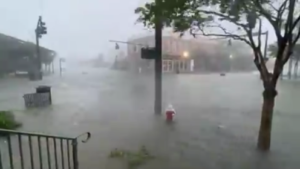
Downtown Pensacola flooding at the height of Hurricane Sally, September 16, 2020
West Florida Study: Ebrahim Ahmadisharaf, a researcher at the Resilient Infrastructure and Disaster Response Center in the FAMU-FSU College of Engineering is leading a team to map vulnerable critical infrastructure around the Pensacola Bay and Perdido Bay watersheds. Compound flooding, inundation from two or more sources simultaneously, is a rising threat to these western Florida communities. Ahmadisharaf and his team will be recording and estimating rainfall intensity and duration in the watersheds, to better understand how they can prepare for coastal flooding. These maps provide municipal and city planners with the information they need on where to place critical infrastructure and how to better protect these investments. New predictions should help make better decisions across the board when it comes to storm and flood response. The work is supported by a $475,000 grant from the Florida Department of Environmental Protection and the tremendous leaders who are innovative thinkers and care about Florida!
LMA Newsletter of 10-9-23

