Quickly intensifying storms a challenge

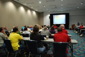
Workshop session at the Governor’s Hurricane Conference in West Palm Beach. Courtesy FGHC
Hurricane Michael was the center of attention among the record number of conferees at the annual Governor’s Hurricane Conference in West Palm Beach last week. The mood was more sober than in past years, given Michael’s impact, including 43 Florida deaths, was so fresh in everyone’s mind. The Category 5 hurricane is causing the National Hurricane Center to once again re-think its forecasting and prompting some fresh thinking on the part of state and local emergency managers, too.
Bay County Emergency Management Director Joby Smith described the very tense days and hours prior to and during Michael’s Cat 5 landfall and the very long days afterward that stretched into weeks. Smith told the 2,200 attendees from almost every Florida county and even some foreign countries about losing all communication – even backup landlines – when the winds hit 60 mph. He was actually in mid-sentence with state officials when the line cut out.
Winds in Bay County would eventually grow to 160 mph, with storm surge of 15.5 feet at Mexico Beach, where Michael’s eye came ashore on October 10. Smith said he had only 73 hours to make final preparations between the first tropical storm advisory and the storm’s landfall. Smith and his counterpart in Calhoun County, Adam Johnson, received standing ovations from the audience.
National Hurricane Center (NHC) Director Ken Graham told conferees that all of the Category 5 hurricanes that have hit the U.S. (the 1935 Labor Day Hurricane and Hurricanes Camille, Andrew and Michael) were tropical storms just three days before landfall. While 2017’s Hurricane Florence gave a ten-day heads-up to the Carolinas, Michael was a quick bloomer. Graham said the NHC is going to have to up its game on quick intensification forecasting.
Michael hit on October 10 as a Cat 4 (later upgraded to a Cat 5 in a post-analysis) and was just a Cat 2 the day before and barely a tropical disturbance two days before that. Of the 18 rapid intensification storms last year (storms that grew by 34 mph or more in 24 hours) only three were forecast correctly. One of the conclusions of the conference was that hurricane preparation exercises should be based more toward a three-day timeline for impact, instead of the current seven-day timeline.
State Emergency Management Director Jared Moskowitz told reporters afterward that Hurricane Michael has shown that the state needs its own post-hurricane housing plan for displaced residents beyond what FEMA can provide. We think it’s also important that we continue to improve building codes and to make sure current buildings are really up to code. May marks the 39th annual Building Safety Month, FEMA’s public awareness campaign that focuses on adopting and maintaining building codes. This year’s theme is No Code. No Confidence. Learn more about the new No Code. No Confidence. (You can put in your address to see if your neighborhood/community has up-to-date building codes, as well as surrounding communities – you may be shocked!)
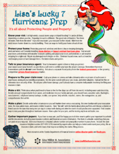
The hurricane conference is part of the state’s annual preparation for the official start of the Atlantic hurricane season, which begins at the end of next week on June 1 and runs through November 30. To prepare you and your clients and colleagues, we’re pleased to present Lisa’s Lucky 7 Hurricane Prep, a fun way to kick off what we should always assume will be a serious hurricane season here in Florida and throughout the Southeast. This whimsical yet practical 7-point list of reminders will help you and yours prepare for the season – with our compliments from Lisa Miller & Associates!
LMA Newsletter of 5-20-19


