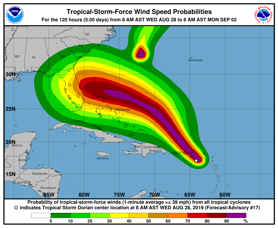
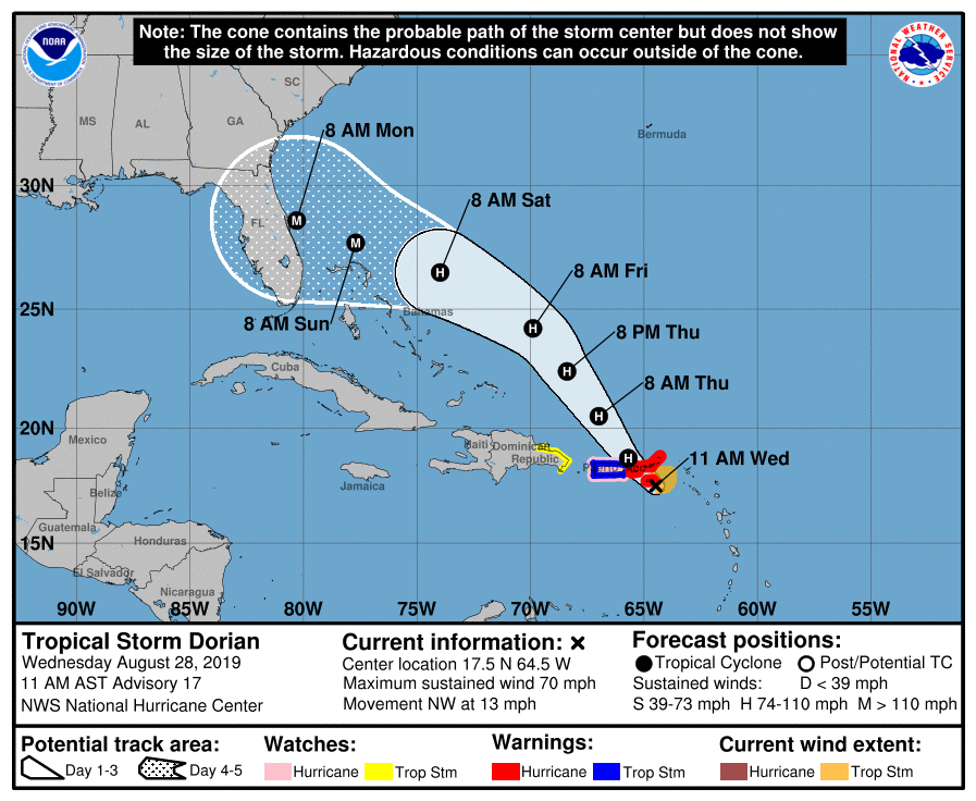
August 28, 2019, AM Update – The Florida Department of Emergency Management (DEM) briefing this morning reveals a significant change in the forecast for Tropical Storm Dorian. The National Hurricane Center reports that the chances of seeing major winds and storm surge have increased substantially since yesterday. Forecasters now say we could be looking at Category 3 or Category 4 hurricane as Dorian approaches the Florida peninsula this weekend. Specifically: All of Florida’s East Coast is in play and South Florida is not off the hook.
(Category 3 hurricanes have winds of 111-130 mph with storm surge of 9-12 feet. Category 4 hurricanes have winds of 131-155 mph with storm surge of 13-15 feet.)
Potential rainfall amounts for Florida are 4-8”, with some isolated areas receiving 10”.
Dorian is now forecast to remain east of Puerto Rico and not have interaction with the U.S. territory. Hurricane development is expected in the next few hours as the storm moves through the northwest Bahamas and then toward Florida.
Some counties along Florida’s east coast are preparing to evacuate their critical needs residents (those on oxygen or have challenges walking) and the Division of Emergency Management briefed the governor today with the emergency operations center (EOC) on full alert.
Below is the latest forecast wind speed probabilities and coastal advisories from the National Hurricane Center as of 8am ET. Click here for a full briefing with maps. Please prepare and be aware!
Lisa & the LMA team


